The California Cadastral Mapping Association or CCMA membership includes staff from Assessor’s Offices within the state of California, and individuals actively employed by other governmental agencies having an interest in cadastral mapping. CCMA is sub-organization of our parent organization, the California Assessors’ Association.
About us
On February 26, 1986, the California Assessors’ Association (CAA) Executive Committee gave approval for a two-day seminar for Cadastral Mapping Supervisors. This workshop was scheduled for October 27-28, 1986 at the Fresno County Library. No registration fee was charged, no group meals were planned, and four hotel/motel suggestions were offered. Participants were encouraged to bring a copy of AH 215 to the meeting.
The CAA agreed to sponsor more seminars of this type on an annual basis, intended for furthering the education, knowledge and communication of cadastral mappers. The seminars consisted of topical presentations and discussions, and provided a forum for mappers to share ideas, experiences, problems, and solutions.
Kern County hosted the seminar in October 1989. The final presentation focused on the status of the CCMA’s formation, followed by an open discussion. It was generally decided that this group wished to be sponsored by the Assessors’ Association, and wanted guidelines to be issued, and wanted the annual meetings to continue.
The following year, Shasta County hosted the annual meeting, where a committee was formed to develop guidelines and bylaws. The Guidelines Committee presented draft bylaws to the group at the 1991 meeting in San Luis Obispo, where they were reviewed and approved by those in attendance. The committee remained in place to work with the CAA to make minor changes and adopt the bylaws. The bylaws were amended and ratified by the members at the 1997 meeting, and were finally approved by the CAA in 1998.

Our Job
“The assessor’s task consists primarily of locating, inventorying, and appraising all property within the county. The first need in inventorying and locating the property is a complete set of maps which shows each parcel of property within the county that is separately owned and used. The extent of the properties within each county is such that no assessor’s office can be efficiently systematized and procedures simplified without a basic system of maps. The basic system of maps must be a coordinated system prepared in accordance with certain standards for the entire county. An office cannot operate efficiently with a heterogeneous collection of miscellaneous maps that do not comprise a coordinated map system.”
– Assessors’ Handbook Section 215, Forward by Verne Walton, Calif. State Board of Equalization, 1992.)
Our Future
Maps were historically drawn by hand with manual drafting instruments, and many are still done this way. But the new world order is emerging with computer technologies: Computer-Aided Drafting (CAD) software has proliferated and brought many improvements to the tools and procedures for several decades, and more recently, Geographic Information Systems (GIS) software is the wave of the future in electronic mapping. The use of these and other automation technologies is rapidly changing the way we do our jobs, even forcing many to redefine job specifications and qualifications and adjust compensation levels.
Our association assures us that we don’t have to blaze new (or old) trails alone; that the experiences of one county can be a resource for another, and that as a group, perhaps we can have a greater influence on the future of our own profession.
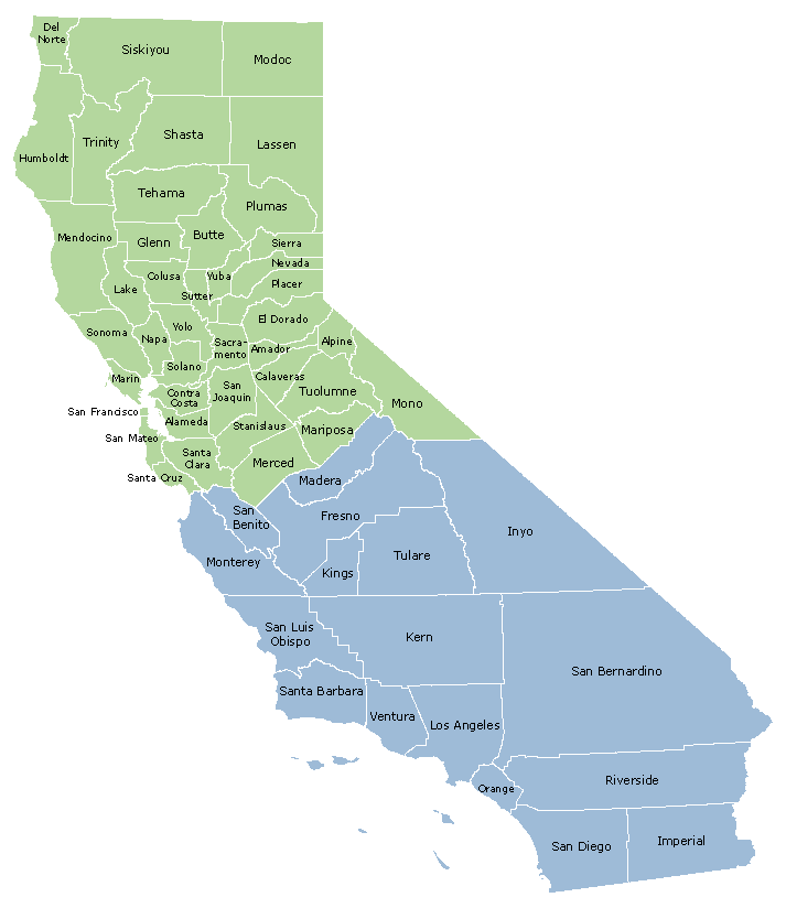
CCMA North-South Boundary
There are 41 northern counties and 17 southern counties


